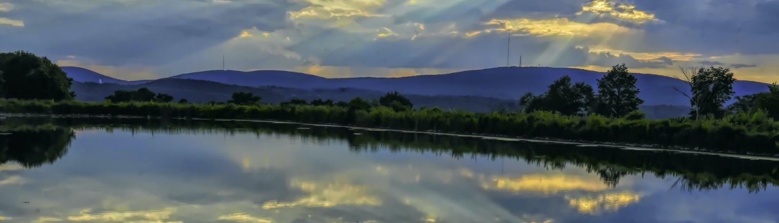
Land and Water Stewardship
The way that land is used – for conservation, development, agriculture, or another purpose – is fundamental to building sustainable communities and limiting greenhouse gas emissions associated with transporting people and goods across long distances. Land use planning is an important priority for Hudson Valley communities in fighting climate change and adapting to a changing climate. While local communities drive land use under the state’s “home rule” policy framework and culture, state and federal planning for transportation, energy and other infrastructure are also important factors.
Land conservation and smart growth
Climate change increases the need for conservation of forests that can absorb carbon and support biodiversity, farms for local food production, and healthy ecosystems that can withstand climate stresses. It also increases the value of concentrated development to reduce dependency on transportation.
The Hudson Valley was an early adopter of the philosophy of “smart growth,” the practice of encouraging development where there is already population and infrastructure. “Smart growth” is a foundational idea in New York State land use policy, and has guided the development of many municipalities with the support of organizations like the Pace University Land Use Law Center, the Greenway Compact and Communities Program, Scenic Hudson and other land trusts that conserve open space with local support. This is a critical strategy for efficient use of resources and preservation of open space, agricultural and forest land. In the 1990s, an innovative partnership between Scenic Hudson and the Builders Association of the Hudson Valley began to map out principles of “smart growth” and secure commitments from local governments to support it.
Smart growth is defined in the Scoping Plan as compact, mixed-use, mixed-income community development that is walkable, bikeable, and transit-accessible and contains a diversity of housing choices, open spaces, and public gathering places accessible to people of all ages, incomes, backgrounds, and mobility capabilities. Smart growth complements, and enables, conservation of land where it matters most. Conserving agricultural, forested, or other natural lands can be done through land acquisition, conservation easements, and tax incentives. Conservation doesn’t just help fight climate change; it protects habitats, strengthens communities, and preserves working land.
In particular, land conservation to provide carbon sinks is a key strategy emphasized in the Scoping Plan, which calls for expanded state investment for this purpose. Protecting 30% of land for conservation by 2030 (“30 x 30”) is a federal policy commitment as well as a goal identified in Governor Hochul’s 2023 State of the State address. The Hudson Valley is well known for its early and extensive land protection efforts and is well positioned to achieve expanded goals through its land trusts, parks, preserves, conservation organizations and some motivated local governments.
But the politics of smart growth and development have become more polarized and complex. The influx of population into the Hudson Valley since the COVID-19 disruption, and the affordable housing crisis, both worsen development pressure and add to the complexity of protecting natural resources and building consensus when it comes to land use. As a result, this region is as vulnerable to sprawl development as anyplace.
Home rule is an important political principle and community value in New York State, and while some communities are motivated to protect open space, others prefer to make development possible wherever it is desired. At a minimum, it is essential to promote a resurgence of education about the value and methods of smart growth development, and the tools that are available to implement it. Setting land use priorities to support farm and forest protection, renewable energy development and working landscapes should be recognized as an integral part of smart growth.Successful NYS investments in redeveloping community centers – such as Upstate Revitalization Initiative grants received by Kingston, Middletown and others – illustrate the financial benefits associated with smart growth from a purely fiscal perspective. Money not invested in new roads and other infrastructure is money available for other public purposes or investment into the private sector. As commercial development continues, climate priorities might lead communities to innovate - for example, by offering accelerated permitting to those new commercial developments that build fossil-free facilities.
More conservation of land is a key strategy emphasized in the Scoping Plan, which calls for expanded state investment for this purpose. Protecting thirty percent of land in undeveloped form is a New York State goal as well as a federal commitment; “30 x 2030” is a federal policy commitment as well as a goal identified in Governor Hochul’s 2023 State of the State address. The Hudson Valley is well known for its early and extensive land protection efforts and is well positioned to achieve expanded goals through its land trusts, parks, preserves, conservation organizations and some motivated local governments.
Although the Valley has been a leader in adopting “smart growth” principles to support conservation, reduce sprawl and guide development into areas where there is already infrastructure, this region is as vulnerable to sprawl development as anyplace. This is especially true in light of the rapid influx of population from the metropolitan NYC area in recent years, and superheated housing markets in some parts of the region. Home rule is an important political principle and community value in New York State, and while some communities are motivated to protect open space, others prefer to make development possible wherever it is desired. The availability of transit has not meant an end to proposals to expand roads for passenger vehicles, such as Route 17 in Orange County. Renewed attention to smart growth - and understanding of its implications - is essential as we tackle climate change and the resource pressures it brings.
At a minimum, it is timely to promote a resurgence of education about the value and methods of smart growth development, and the tools that are available to implement it. Successful NYS investments in redeveloping community centers – such as Upstate Revitalization Initiative grants received by Kingston, Middletown and others – illustrate the financial benefits associated with smart growth from a purely fiscal perspective. Money not invested in new roads and other infrastructure is money available for other public purposes or investment into the private sector. As commercial development continues, climate priorities might lead communities to innovate by offering accelerated permitting to those new commercial developments that build fossil-free facilities.
Planning boards, elected officials, large and small landowners, and entire communities need to educate themselves on their options and make sure that productive land is preserved for cultivation, and underproductive land is prioritized for renewable energy. Also relevant to smart growth is protecting water and watershed resources, a topic that will be expanded upon in the Water Stewardship discussion ahead. In particular, development must be prioritized where there are adequate water resources. Climate-informed wetland and watershed planning is an essential underpinning of land use, all the more as climate changes. The major organizations that have popularized land and water conservation - including Scenic Hudson, land trusts, county planning departments and expert organizations such as Pace Land Use Law Center - have developed an informal but effective communication network to help communities respond rapidly to development proposals; this network could serve as a basis for periodic educational campaigns that make sure strong expertise is embedded in the communities facing these pressures.
Comprehensive plans are typically updated no more than every 5 – 10 years, and many municipalities still lack these tools. Development pressures and opportunities can be hard to anticipate and diverse – local governments are grappling with affordable housing needs, transportation infrastructure, renewable energy siting and conservation needs, too often in isolation and without coordination. The need is not simply to maximize conservation or agriculture or forestry or housing or sites for renewable energy, but to optimize land use planning for community benefits and climate protection value. The majority of Hudson Valley communities lack extensive planning staff, so a fundamental need is for flexible, affordable assistance that is matched to local needs as they evolve. This could be addressed with an informal network linking the organizations that already provide some land use planning assistance - from Scenic Hudson to the Hudson River Watershed Alliance - to keep better on top of widely distributed needs and pool resources when major issues emerge.
To begin addressing these challenges in a more coordinated manner, the Hudson Valley Affordable Housing and Conservation Strategy was created in 2023 by the Regional Plan Association with a group of stakeholders including land trusts and housing organizations. This simple effort was built on a statement of common values such as equitable access and improved decision making.
The project identified places with signs of political will for both land conservation and affordable housing. They are mapped here, along with core forests and agriculturally-zoned areas, and some potential renewable energy sites that are currently being explored by communities. This map illustrates the possibility for integrated planning for conservation, farm and forest preservation and appropriate renewable energy siting.


Partners in this project are following up with efforts to implement both conservation and affordable housing initiatives in these locations, and can benefit from continuing political support. Including renewable energy systems in and around new affordable housing developments, and working with municipalities on comprehensive plans that support both, could be a next step for the Affordable Housing and Conservation Strategy or for allied groups such as Climate Smart and Clean Energy Community volunteers in these communities. The organizations working specifically on renewable energy siting within this Road Map - such as New Yorkers for Clean Power and Ulster County’s “30 x 70” project - could identify opportunities in these motivated communities. This map identifies the communities identified by the Affordable Housing and Conservation Strategy, as well as some existing and possible renewable energy sites, as a foundation.
Sequestering carbon and supporting biodiversity on private lands: an opportunity for everyone
The ‘perfect’ lawn requires significant energy and resources in the form of irrigation, mowing, pesticides, chemicals, and time. Mowing, and fertilization in particular, leads to large-scale pollution in the form of fossil fuel use and chemical runoff into local and national water systems. By contrast, perennial gardens and meadows require very little upkeep and benefit biodiversity as well as climate.
Private and public lands alike can be locations for demonstrating new practices in soil health and carbon sequestration as these fast moving fields advance. Ninety percent of land in the US is privately owned. This means that home gardeners, land trusts and institutional landowners alike can play a major role with new landscaping practices that reduce climate impacts and help at-risk species to thrive. Homegrown National Park, a “just do it” program launched by renowned biologist Douglas Tallamy, provides how-to guidance, plant lists and a map for landowners to show what they are doing. Over 37,000 sites in the U.S. and Canada have registered as participants. Some Climate Smart teams - notably Columbia County’s – are encouraging this in surrounding communities. This decentralized vision has also given rise to a vigorous movement whose labors have resulted in a “Pollinator Pathway” for the Hudson Valley, from new meadows on the SUNY New Paltz campus to regenerative plantings – fittingly – at the Regeneron corporate headquarters. Sophisticated tools are publicly available for planning afforestation and sustainable landscaping at the property scale, such as USDA’s ITree and Tree Atlas. Some new land management practices are easy for amateurs to take on – for example, pollinator plantings. Trees and shrubs capable of surviving in urban environments have higher costs, $250 and more for a single shade tree. Serious investment in these kinds of programs by philanthropies and economic development organizations, especially for supplies, equipment and workforce development, could be a major job-creation opportunity in the landscape and horticulture sector while achieving restoration goals on private lands. Groundwork Hudson Valley is leading the development of this industry with a multi-year urban forestry workforce development program.
Watershed Planning and Green Infrastructure for Water Quality and Climate Resilience
Protection of watersheds and water quality are climate mitigation as well as adaptation measures, since both help to avoid the need for new and sometimes energy intensive water supply options, while improving the resilience of watersheds to provide water of sufficient quantity and quality for human uses. Water stewardship organizations are increasingly working together to revive and strengthen watershed and water supply planning programs. Watershed planning is a complex, location-specific activity that calls on expertise from many disciplines and requires engagement of diverse community stakeholders to make value judgments about local priorities. It requires serious, multi-year investment of person-power but pays off richly.
As climate pressures increase and climate change impacts are better understood, the practice of watershed planning can and must be modified to take new factors into account. These include possible migration patterns of plant and animal species, the capacity of the land to absorb storm- and floodwaters, and strategies for restoring ecosystems that will fit emerging conditions. There is no standard method for approaching this, but the fast growing recognition of water stresses suggests that more aggressive attention to protection and restoration is a core element. All watersheds are impacted by human activity, but urban watersheds are especially linked to the public health benefits of clean air and water, cooling, pollinator and wildlife access, making climate-informed watershed planning a focal point for achieving local environmental justice. Developing a model climate-informed watershed plan in an urban watershed such as the Quassaick in Newburgh would advance this work and provide a replicable model for other urban watersheds.
Given the stresses on water resources, watershed planning is not simply about ensuring supply but must focus on improving conservation and efficiency. In 2011, the American Planning Association called on planners to: “Give priority to measures which improve water use and energy efficiency, such as conservation and reuse, as opposed to measures which would simply increase water supply... Implement operations and pricing policies that reward conservation and accurately reflect distribution costs. Balance ‘duty to serve’ requirements with other community goals, including growth management and water supply and rate stability.”
“Green infrastructure” is the creation of low-impact landscape and design strategies that manage stormwater runoff and floods while also providing benefits such as cooling and visual appeal. In 2019, Congress enacted the Water Infrastructure Improvement Act, which defines green infrastructure as "the range of measures that use plant or soil systems, permeable pavement or other permeable surfaces or substrates, stormwater harvest and reuse, or landscaping to store, infiltrate, or evapotranspirate stormwater and reduce flows to sewer systems or to surface waters." This valuable approach has been effectively demonstrated at the site level (e.g. the green roof over SUNY Orange’s Kaplan Hall in Newburgh) and in larger landscapes such as the downtown area in Hoboken, NJ.
Planning for green infrastructure was going on as long ago as 2010-2011, when the Hudson Valley Regional Council supported the planning and conceptual design of several dozen green infrastructure projects as municipally owned sites. At that time, the City of Newburgh also created a guidance document for green stormwater infrastructure that has not yet been significantly put to use. This design work could provide a foundation for fast track green infrastructure projects in valuable locations.
Smart growth has been discussed above, but one aspect of smart growth is often neglected: its dependence on the availability of water and wastewater infrastructure in priority growth areas. The fact that an area is approved for development in a comprehensive plan, does not always guarantee that a water supply or wastewater system serving it has sufficient capacity to support significant new development. For smart growth to be feasible, adequate capacity must be planned in the infrastructure serving designated growth areas. Right now, NY State’s approach to water resources monitoring, planning and management is inadequate for achieving this goal in many geographic areas. Increased funding is needed for source water protection, watershed planning, and watershed restoration as coordinated activities. This could be a worthy investment of Bond Act funds.
The state should also increase staffing and other resources for using available information to track water withdrawals in areas with potential risks of shortages, including areas of more rapid development that draw on groundwater for water supplies. The state should also explore strategies for supporting local and regional studies of groundwater availability in these areas. A structured, multi-agency approach to regional water planning should be used to avoid future stresses on water supply resources that would otherwise harm affected communities, the regional economy, and environmental resources. In fact, much of this is outlined in existing state law (primarily the Environmental Conservation Law, or ECL) that has not been fully implemented.
To realize the potential for this renewed planning effort, the state (through DEC or by means of an inter-agency approach) should revive statewide water supply planning, using existing ECL provisions as a foundation. This includes steps to:
Increase resources and incentives for existing watershed planning and management programs, including Drinking Water Source Protection Program, DOS watershed planning, 9-element and TMDL planning, flood risk management planning, etc.
Implement a system of regional water supply planning, prioritizing areas with current or projected deficits in source water availability and piloting approaches in the Hudson Valley.
Develop watershed protection and source water protection plans and local regulation to protect and augment aquifer recharge.
Build upon existing source water protection efforts, with a priority on source waters that are high-yield, highly vulnerable, and stressed regarding water supply or water quality;
Ensure tracking of demand for projected developments, especially in connection with these source waters;
Clarify what authority and responsibility is currently held by DOH,DEC, local governments or other entities to limit new development where available water is not sufficient.
As these plans are developed, strategies should be put in place to use the statewide and especially regional water supply plans as the basis for regulatory decisions.
A model to consider adopting is Massachusetts’ Sustainable Water Management Initiative (SWMI). Now a statewide legal framework, SWMI was developed by the Executive Office of Energy and Environment through formation of a broad stakeholder advisory group which conducted a two-year planning process. After piloting in four water utility districts, SWMI was adopted as a statewide water management framework. In essence, it is a program to guide allocation of water resources for human uses while operating within the limits of natural systems. Ten years since its adoption, the framework is generally accepted and operates smoothly.
Flooding Adaptation and Resilience
Given the erratic patterns and extreme levels of flooding that we are already seeing, all possible attention should be paid to flooding adaptation and resilience by local governments, stewardship organizations, affected communities and public safety/ emergency management agencies - preferably in a coordinated fashion. All these parties need high-quality education and training about basic climate change science and predictions, including a focus on uncertainty and how to think about and apply this in planning and management decisions.
Generally speaking, implementing site-scale green infrastructure for stormwater management is useful for reducing local flooding across properties, roads and parking lots.
To protect public safety, there is a need for tighter municipal regulation of development in flood-prone areas. One good approach is using the FEMA Community Rating System framework for reducing risks and thereby gaining reduced insurance rates for property owners. Difficult though it is, local governments and communities should begin to explore the subject of strategic relocation out of flood-prone areas.
To deal with upland flooding in developed areas, resulting from large, sudden rainfalls, communities should plan for evacuation and for longer-term retrofitting of places at risk (like basement apartments) or creating voluntary, flexible options to make sure that people in those places can access emergency shelter or find alternative places to live.
Depleted aquifers increase flood risks; conversely, there is a reduction in flood impacts by augmenting recharge through watershed protection, source water plans and local regulation. If flooding events increase in number and severity, as predicted, this will likely put stress on New York City’s water supply system. Because of resulting increases in turbidity that watershed land management will not be sufficient to control, the City may have difficulty complying with the Filtration Avoidance Decision, potentially making it necessary to invest in a costly filtration system for its drinking water supply.
Stormwater management is closely connected with flood management, and good stormwater management can contribute to other aspects of resilience. For example, using stored stormwater for irrigating trees and other landscaping can be key to promoting cooling on the hottest days. As extreme heat events increase, the critical public health risks of heat stress may be reduced by using water to enhance growth of trees. Urban areas with ample tree canopy cover can remain much cooler compared to areas with few trees, reducing peak loads on the power grid and the risk of power outages, and potentially saving lives. These cooling benefits are particularly important in economically vulnerable communities and others with less access to air conditioning.
One good way to capture these benefits is an education and technical assistance initiative to support best practices in stormwater management and flood resilience. Expand the notion of vulnerability assessment to include not only flood likelihood and physical damage, but secondary impacts in the community and opportunities to engage and prepare people in advance.
Investing in Sustainable Shorelines
Shorelines are a point of special need for attention to land and water management. New York’s Department of State and the Hudson River Estuary Program have supported numerous local waterfront plans. However, a look at the urban waterfronts from Hudson down to Beacon shows that land uses tend to be focused on recreation and tourism - an understandable but limited range of activities that could be expanded on — if done in conjunction with planning to address sea level rise by identifying locations that will be inundated, where design for flooding or managed retreat are necessary. If renewably-powered maritime transportation is to be developed as a partial alternative for shipping non-perishable goods and relieving commuter traffic on our bridges, and iff fisheries are brought back for sustainable management - the opportunity for more diversified working waterfronts presents itself. This is illustrated by Kingston’s “Weaving the Waterfront” plan, which identifies strategies for public lands in detail and could serve as a platform for further exploration of commercial opportunities on privately owned properties. Docking for small low-impact passenger and freight vessels, aquaculture, bike and scooter rentals are among the activities that might serve as foundation for a more diversified working waterfront.
Waterfront planning in many communities has a strong environmental justice dimension. This is dramatic in Newburgh. In the 1960’s and 1970’s, the expansion of Stewart Airport and commercial development, combined with Urban Renewal displaced 1,500 homeowners, including hundreds in a mixed-use neighborhood bordering on the waterfront. Today, that neighborhood is a brownfield that has been funded for cleanup and re-use planning - a process that has attracted an increasingly diverse citizen leadership, and may serve as a model for other efforts combining land reuse, environmental restoration, and restorative justice.
Like mixed land uses for renewable energy and agriculture, this expanded mixture of uses must be carefully conceived and planned with environmental impacts as well as economic potential and community benefits considered. Just as the major environmental organizations have worked together to consider environmental impacts of energy siting decisions, this presents an opportunity for proactive joint planning.